
Laser scanning and photogrammetry
High precision 3D data capture
Surrey-based, serving Dorset and throughout the UK
LASER SCANNING SURVEYS
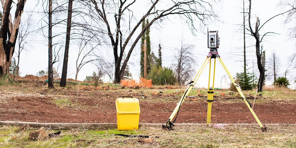
Our Trimble X7 produces highly accurate 3D point clouds registered to a local grid or Ordnance Survey coordinates using a Total Station. This technology ensures seamless integration into your workflow, with output files compatible with Revit and Blender. We provide laser scans for a wide range of needs, including measured building surveys, street scene elevations, as-built surveys, and heritage properties or sites. Whether you are working on modern construction projects or preserving historical structures, our process guarantees clarity, precision, and efficiency from start to finish. Also, we hold a Civil Aviation Authority Permission for Commercial Operations Licence, allowing us to carry out projects safely, legally, and with full compliance.
Reach out to us for more details regarding our offerings:

PROJECTS WE HAVE DELIVERED


FIRST-CLASS SERVICE
Delivering exceptional workmanship on every project with attention to detail and client satisfaction.
MODERN, HIGH-END EQUIPTMENT
Committed to using high-end equipment and precise techniques to ensure long-lasting, flawless results.
MANY YEARS’ EXPERIENCE
Bringing many years of hands-on expertise across all areas of ground surveying and scanning.